


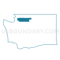
Anacortes 22 Voting District, Skagit County, Washington
About
Outline

Summary
| Unique Area Identifier | 688384 |
| Name | Anacortes 22 Voting District |
| County | Skagit County |
| State | Washington |
| Area (square miles) | 1.10 |
| Land Area (square miles) | 1.03 |
| Water Area (square miles) | 0.07 |
| % of Land Area | 93.82 |
| % of Water Area | 6.18 |
| Latitude of the Internal Point | 48.49698970 |
| Longtitude of the Internal Point | -122.65222120 |
Maps


Graphs
Select a template below for downloading or customizing gragh for Anacortes 22 Voting District, Skagit County, Washington


Neighbors
Neighoring Voting District (by Name) Neighboring Voting District on the Map
- Anacortes 20 Voting District, Skagit County, WA
- Anacortes 21 Voting District, Skagit County, WA
- Anacortes 9 Voting District, Skagit County, WA
- Fidalgo Voting District, Skagit County, WA
- Guemes Channel, Skagit County, WA